Cool Summer Hikes Near China's Top Tourist Cities: Beat the Heat
China welcomed 22.914 million foreign arrivals in the first half of 2026 — a 20.4% year-on-year increase, with 77.7% entering via visa-free policy. The top 20 destination cities read like a who's-who of Chinese tourism: Shanghai, Beijing, Guangzhou, Shenzhen, Chengdu, Hangzhou, Xiamen, Haikou, Qingdao, Chongqing, Fuzhou, Kunming, Nanjing, Shenyang, Xi'an, Wuhan, Harbin, Changsha, Dalian, and Zhengzhou.
But here's what those travel brochures won't tell you: summer in China is hot. Brutally hot. Temperatures of 35-40°C blanket most major cities from June through August. Shanghai feels like a sauna. Beijing bakes. Chongqing is practically an oven. For hikers who've traveled halfway across the world, this can be a real problem.
The good news? China's top tourist cities are all within reach of high-altitude trails where summer temperatures drop by 10-20°C. From bamboo-forested hills near Shanghai to alpine meadows above Beijing, from karst caves in Chongqing to sacred peaks in Western Sichuan — there's a cool escape within a few hours of every major city. This guide covers 12 routes near the top 8 inbound tourism cities, plus premium routes in Yunnan and Western Sichuan for those willing to venture further.
The 30-Second Version
- 12 cool-weather routes near Shanghai, Beijing, Guangzhou, Shenzhen, Chengdu, Hangzhou, Xi'an, Xiamen, Chongqing + Yunnan & Western Sichuan
- Temperature drops of 10-22°C from city to trail — most routes stay under 26°C even in peak summer
- All routes accessible within 1-4 hours from city centers by train, bus, or car
- Difficulty range: From easy family strolls (Moganshan, Nankunshan) to hard multi-day treks (Yubeng, Genyen)
- Visa-free entry: 77.7% of foreign visitors used visa-free policy in H1 2026 — most of these trails require no special permits
- Best summer window: July-August for wildflowers at altitude; early September for cooler, drier conditions
1. Shanghai → Moganshan (苣干山): The Bamboo Sea Escape
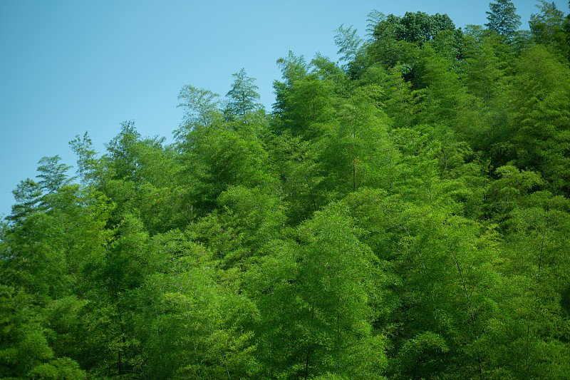
Moganshan's bamboo forests offer 10°C+ of relief from Shanghai's summer heat
Just two hours from Shanghai's concrete canyons, Moganshan rises out of Zhejiang's bamboo country like a green mirage. At 700m elevation with 92% forest coverage, this is where Shanghai's expats and Chinese weekenders flee when the city hits 39°C. The summit stays a pleasant 22-26°C — a dramatic 10°C+ drop from the sweltering city below.
Climate & Temperature
- Summer temp (summit): 22-26°C; Shanghai city: 35-39°C
- Daytime in bamboo shade: 25-28°C — feels cooler due to shade and breeze
- Nighttime: Drops to 20°C; bring a light jacket
- Humidity: Can be high in July during plum rain (梅雨) season; mosquito repellent essential
Trail Highlights
- Bamboo forest trails: Endless corridors of giant moso bamboo swaying overhead
- Biwu Dragon Pool (碧坰龙潭): Stream walking through cool, shaded gorges
- Jianchi / Sword Pool (剑池): Waterfall and pool where legend says the ancient swordsmiths Gan Jiang and Mo Ye forged their blades
Access
1 hour by high-speed train from Shanghai Hongqiao to Deqing Station (德清站), then 20 minutes by taxi to the trailhead. Alternatively, 2 hours by car via the G50 expressway.
Best for: Day trips or overnight stays. Beginner-friendly, family-friendly. The perfect first hike for visitors new to China who want nature without straying far from Shanghai's comfort zone.
2. Beijing → Donglingshan (东灵山): Alpine Meadow on Beijing's Highest Peak
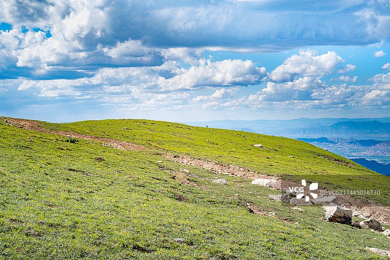
Donglingshan's alpine meadow at 2,303m — Beijing's highest point and coolest summer escape
At 2,303m, Donglingshan is Beijing's highest peak — and its coolest. While the city swelters at 38°C, the summit sits at a refreshing 17-22°C, dropping to as low as 10°C at night. Above 1,700m, the forest gives way to open alpine meadow — a landscape more reminiscent of Inner Mongolia than the capital of China. In July, the meadow erupts with golden lotus flowers (金莲花), and cattle graze freely across the rolling grasslands.
Climate & Temperature
- Summer temp (meadow): 17-22°C; Beijing city: 33-38°C
- Summit nighttime: Can drop to 10°C even in midsummer
- Wind: Strong winds at the exposed summit — bring a windbreaker jacket
- Rapid changes: Fog and rain can roll in within minutes; weather changes fast on the exposed ridge
Trail Details
- Route: Jiangshuihe Village (江水河村) to summit, 6km round trip
- Duration: 4-5 hours
- Elevation gain: ~800m
- Difficulty: Moderate — sustained uphill but well-defined trail
- Highlights: Alpine meadow, golden lotus flowers (July), grazing cattle, panoramic views of the Western Hills
Access
2-3 hours by car from Beijing to Jiangshuihe Village. Public transport: Bus 892 from Pingguoyuan subway station to Hongshuikou, then a short hike to the trailhead. A car or hired driver is strongly recommended for convenience.
Spending a day or two in Beijing before or after your Donglingshan hike? Don't miss the Forbidden City — but plan carefully to avoid the crowds. Our Forbidden City wait times guide has hour-by-hour queue data and the best arrival times for summer 2026.
Sources: 什么值得买 2026; 千龙网 2026-07-15
3. Guangzhou & Shenzhen → Nankunshan (南昆山): Oasis on the Tropic of Cancer
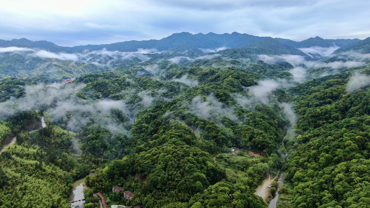
Nankunshan's 97.94% forest coverage makes it a natural air conditioner for the Pearl River Delta
Guangzhou and Shenzhen in summer are famously oppressive — 33-35°C with 80%+ humidity that makes the air feel thick. But just two hours away, Nankunshan rises from the Guangdong countryside like a verdant fortress. With 97.94% forest coverage and an average elevation of 600m (peaking at 1,228m at Tiantangding, or "Paradise Peak"), it's been called the "Oasis on the Tropic of Cancer." Summer temperatures hold at a comfortable 23-25°C — 6-8 degrees cooler than the Pearl River Delta cities below.
Climate & Temperature
- Summer temp: 23-25°C; Guangzhou/Shenzhen: 33-35°C
- Nighttime: Drops to ~23°C
- Shade: Dense forest canopy throughout — virtually no sun exposure on trails
- Streams: Cool mountain water perfect for wading and cooling off
Trail Highlights
- Chuanlong Waterfall (川龙玩洪): A 21.8m waterfall with a mist-filled gorge
- Stone River Wonder (石河奇观): Seven emerald pools connected by a mountain stream — ideal for wading
- Tiantangding summit (天堂顶): 1,228m peak with panoramic views over the forested ridgelines
Access
2 hours by car from Guangzhou or Shenzhen via the G355 expressway. No direct train; car rental or ride-hailing (DiDi) is the standard approach.
Best for: Family wading, bamboo forest walking, beginner trail. The stream pools make this one of the few Chinese hikes where you can actually cool off in the water mid-hike.
Sources: Sina 2026-08-03; Toutiao 2026-07-28
4. Chengdu → Bipenggou (毕棚沟) & Mount Siguniang (四姑娘山)
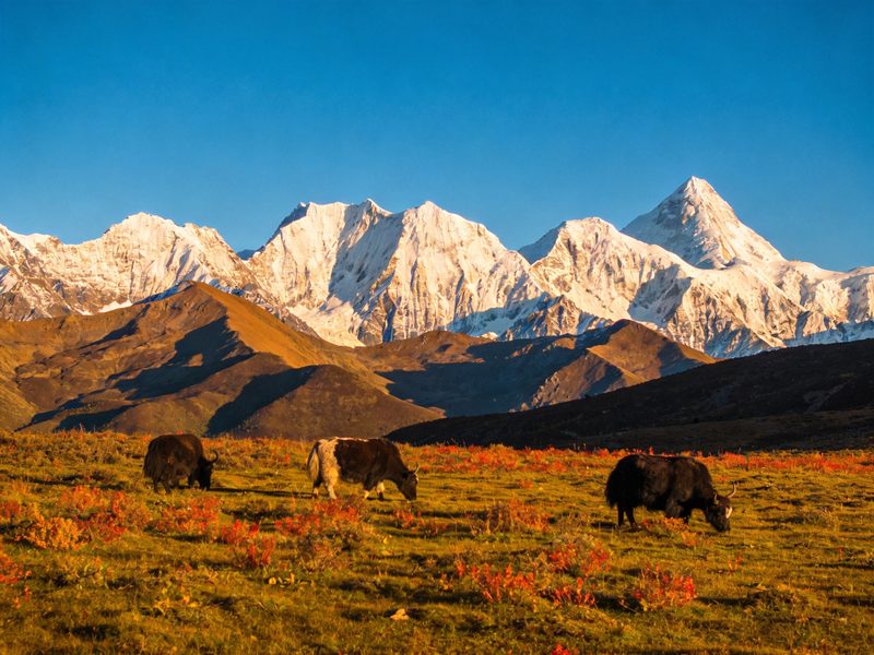
Mount Siguniang's Changping Valley — 15-25°C in summer, with snow peaks reflecting in alpine streams
Chengdu in summer is a bowl of humid heat — 30°C and sticky. But just 2.5 hours west, the Tibetan Plateau begins its dramatic rise, and with it comes a completely different climate. Bipenggou and Mount Siguniang sit in the transition zone between Sichuan Basin and the eastern edge of the Qinghai-Tibet Plateau, offering summer temperatures of 15-20°C during the day and 5-10°C at night. You'll go from sweating in Chengdu to reaching for a down jacket in a single afternoon's drive.
Bipenggou (毕棚沟)
- Summer temp: 15-20°C day, 5-10°C night
- Elevation: 2,400-4,500m
- Access: 2.5 hours by car from Chengdu
- Highlights: Panyang Lake (磺羊湖) with snow mountain reflections, Bailong Waterfall (白龙玩洪), and the 3,800m Swallow Rock Nest (深子岩窝) alpine meadow
Mount Siguniang (四姑娘山)
- Summer temp: 15-25°C day, 8-12°C night (July-August)
- Elevation: Up to 6,250m (summit); popular trekking at Changping Valley (长坩沟) 3,200-3,800m
- Access: 4 hours by car from Chengdu, or bus from Chadianzi Station (茶店子客运站)
- Highlights: Four sister peaks, ancient forests, alpine meadows, Tibetan culture
Climate Notes
The day-night temperature difference exceeds 15°C. UV radiation is extreme at this altitude — SPF50+ sunscreen, sunglasses, and a hat are non-negotiable. Altitude sickness becomes a real concern above 3,500m. Symptoms include headache, nausea, and shortness of breath.
Sources: Trip.com 2026-07-25; Sina 2026-08-01
5. Hangzhou → Tianmushan (天目山): Walk Through a Living Forest Cathedral
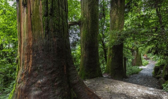
Tianmushan's 1,000-year-old Cryptomeria trees create a shaded cathedral — 22-25°C all summer
Hangzhou's West Branch is postcard-perfect in spring, but by July the city bakes at 35-38°C. Just 1.5 hours northwest, Tianmushan rises to 1,500m, draped in a forest so dense that hikers literally "can't see the sun" on the trail. With 95% forest coverage and temperatures of 22-25°C (7-10°C cooler than the city), it's one of eastern China's most underrated summer escapes.
Climate & Temperature
- Summer temp: 22-25°C; Hangzhou city: 35-38°C
- Nighttime: Drops below 20°C
- Canopy: Full forest shade throughout the trail — sun exposure is minimal
- Air quality: Negative oxygen ions are extremely high; Tianmushan is known as a "natural oxygen bar" (天然氧吧)
Trail Details
- Classic route: Chanyuan Temple (禅源寺) → Big Tree King (大树王) → Kaishan Old Hall (开山老堂)
- Distance: 6-8km
- Duration: 4-6 hours
- Difficulty: Easy to moderate — well-maintained stone steps and forest paths
What Makes Tianmushan Special
- World's largest ancient Cryptomeria forest: Over 1,000 trees exceeding 1,000 years old, some reaching 40m+ in height
- World's tallest Dawn Redwood: A single specimen reaching 58m — the tallest of its kind on Earth
- Five-Generation Ginkgo (五代同堂): An ancient ginkgo tree where five generations of branches grow from a single root system, estimated at over 12,000 years old
Access
1.5 hours by car from Hangzhou, or take a bus from Hangzhou West Bus Station to Tianmushan Town (天目山镇), then a short taxi to the scenic area entrance.
Best for: All levels, including families with children 5+. The ancient trees make this as much a nature education experience as a hike. UNESCO Biosphere Reserve status adds cultural and scientific value.
Sources: Hangzhou.gov.cn 2025-08-14; zhunaqu.com 2026
6. Xi'an → Taibaishan (太白山): The Roof of Central China
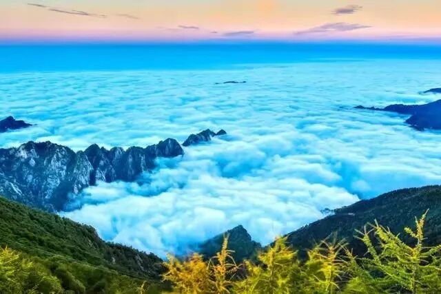
Taibaishan's 3,767m summit — the highest peak east of the Qinghai-Tibet Plateau, with summer temps of just 10-15°C
Xi'an is famous for the Terracotta Warriors, but in summer it's equally famous for 40°C heat. The escape? Taibaishan — at 3,767m, the main peak of the Qinling Mountains and the highest mountain east of the Qinghai-Tibet Plateau. The Qinling range is China's biological dividing line between north and south, and Taibaishan's vertical vegetation zones span from temperate forest at the base (620m) to alpine meadow and glacial features at the summit. Summer temperatures at the top hold at just 10-15°C, with residual snow possible even in July.
Climate & Temperature
- Mountain base (620m): ~26°C
- Mid-mountain: ~20°C
- Summit (3,767m): 10-15°C, even in July
- Temperature gradient: Drops 6°C per 1,000m of elevation gain
- Summit conditions: Windbreaker or light down jacket essential. Residual snow patches may persist on north-facing slopes.
Trail Details
- Route: Scenic bus to Xiabansi (下板寺) → cable car to Tianyuan Difang (天圆地方, 3,511m) → hike to Baxiantai (八仙台, 3,767m)
- Duration: 6-8 hours round trip (including transport)
- Difficulty: Hard — the final section from 3,511m to 3,767m is a steep, exposed alpine route
- Highlights: Alpine meadow, glacial lakes, cloud sea (云海), dramatic vertical vegetation zones from temperate to alpine
Access
1.5 hours by car from Xi'an to Tangyu (汤立), the main entrance. Alternatively, take a bus from Xi'an Bus Station (西安汽车站) to Tangyu.
Sources: Sina 2026-07-31; Sina 2026-07-26
7. Xiamen → Wuyishan (武夷山): UNESCO World Heritage & Biosphere Reserve
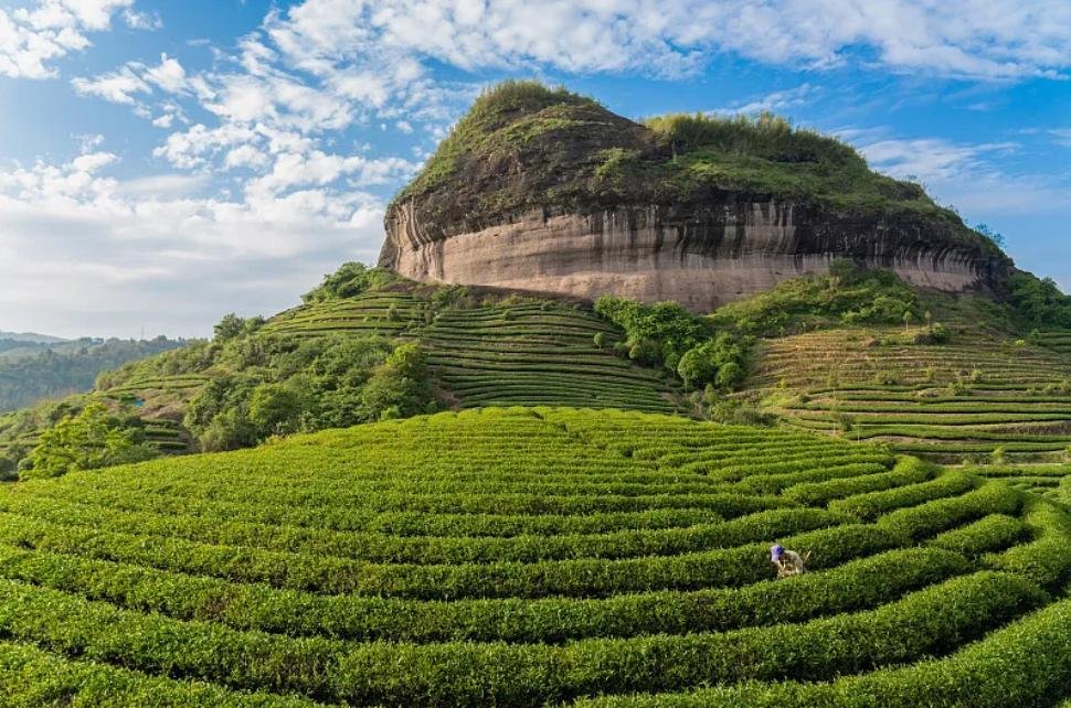
Wuyishan's Danxia red cliffs and tea terraces — a UNESCO dual heritage site at 22-28°C in summer
Xiamen is one of China's most pleasant coastal cities, but summer still pushes temperatures to 33-36°C with tropical humidity. Two and a half hours north by high-speed train, Wuyishan offers a completely different world — Danxia red cliffs, ancient tea plantations, and forested peaks that hold at 22-28°C in the mountain areas. It's one of only a handful of sites worldwide to hold dual UNESCO status: both World Heritage (cultural landscape) and Biosphere Reserve (natural ecology).
Climate & Temperature
- Summer temp (mountain area): 22-28°C; Xiamen city: 33-36°C
- Forest areas: 3-5°C cooler than the city due to canopy shade and elevation
- Nighttime: Drops below 20°C
- Thunderstorms: Common in July-August, typically in the afternoon — plan morning hikes
Trail Highlights
- Nine-Bend Stream (九曲溪) bamboo raft: A iconic 2-hour float through the Danxia gorge — the rafting provides natural water-mist cooling
- Tianyou Peak (天游峰): The park's signature summit, 2-3 hour round trip with panoramic views of the winding river below
- Dahongpao to Water Curtain Cave (大红袍→水帘洞): A 4.5km forest trail through ancient tea terraces and natural wind caves that provide cooling breezes
- Qinglong Waterfall (青龙玩洪): A spectacular waterfall tucked into a forested gorge
Access
2.5 hours by high-speed train from Xiamen North (厦门北) to Wuyishan East (武夷山东). Shuttle buses connect the station to the scenic area entrance.
Best for: All levels. The combination of cultural (tea ceremony, ancient cliff inscriptions) and natural scenery (Danxia geology, forest trails, river rafting) makes Wuyishan ideal for mixed-ability groups where some want to hike and others prefer gentler activities.
Sources: Toutiao 2026-07-25; Sina 2026-07-28
8. Chongqing → Jinfo Mountain (金佛山): Walking Into a Refrigerator
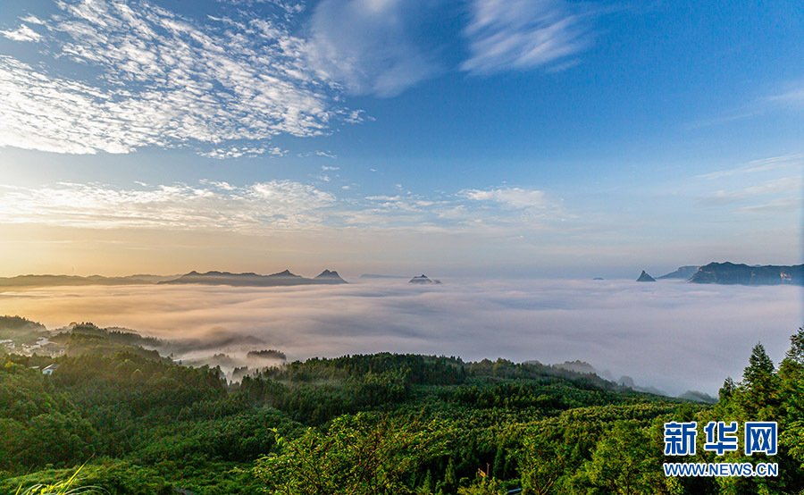
Jinfo Mountain's 2,238m summit — a World Natural Heritage site where summer temperatures hold at 16-19°C
Chongqing is famously one of China's "furnace cities" (火炉) — summer temperatures of 38-40°C are routine, and the city's basin geography traps heat and humidity. But 1.5 hours south, Jinfo Mountain rises to 2,238m as part of the South China Karst World Natural Heritage. The summit holds at 16-19°C in summer — Chongqing locals describe the cable car ride up as "walking into a refrigerator." The temperature drop from city to summit can exceed 20°C.
Climate & Temperature
- Summit (2,238m): 16-19°C day, 15-19°C night
- Mid-mountain: 20-25°C
- Chongqing city: 38-40°C
- Ancient Buddha Cave (古佛洞): Naturally air-conditioned at 12°C year-round — a literal underground fridge
- Cloud sea: Frequently appears after rain, especially in early morning
Trail Highlights
- Cliff boardwalk: A spectacular walkway carved into the karst cliff face
- Ancient Buddha Cave (古佛洞): A massive karst cave system maintaining a constant 12°C — the ultimate natural air conditioning
- Bitan Valley (碧潭谷): A stream walk through forested karst formations
- 96% forest coverage with rare wildlife including snub-nosed monkeys (in remote areas)
Access
1.5 hours by car from Chongqing, or 22 minutes by high-speed rail to Nanchuan North (南川北) followed by a transfer bus to the scenic area.
Sources: Toutiao 2026-08-04; Sina 2026-07-24
9. Yunnan Premium Routes: Tiger Leaping Gorge & Yubeng
If the routes above are appetizers, Yunnan is the main course. For hikers willing to venture beyond the top tourist cities, Yunnan offers two of Asia's most spectacular multi-day treks — both at elevations and latitudes that keep summer temperatures remarkably cool.
Tiger Leaping Gorge (虎跳峡)
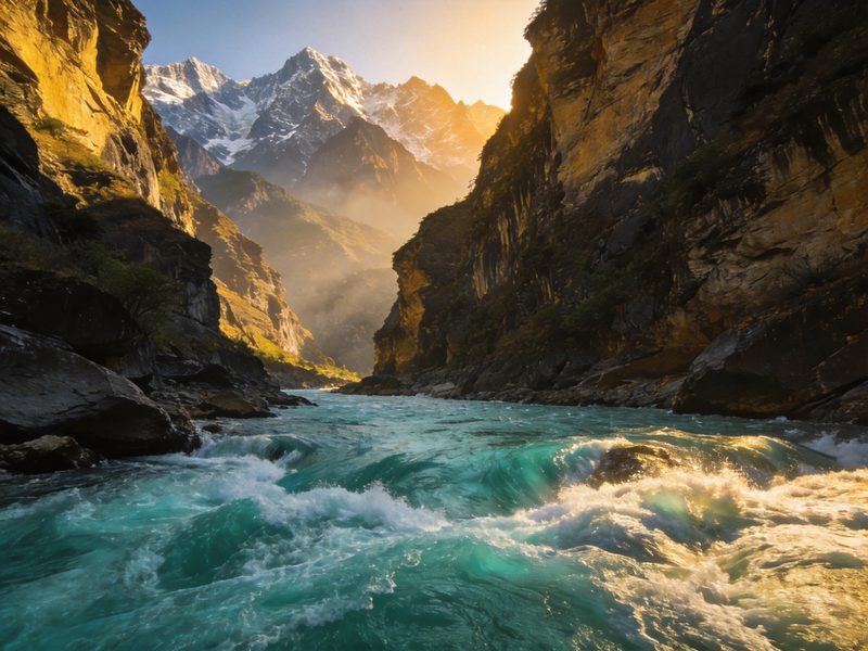
The world's deepest canyon — 3,790m from rim to river — carved by the Jinsha River as it forces its way between Jade Dragon Snow Mountain and Haba Snow Mountain. The high trail follows the gorge's northern rim through 28 switchbacks, vertical cliff paths, and waterfalls that cascade directly onto the trail.
- Summer temp: 16-23°C (July-August)
- Elevation: 2,670m (high trail)
- Duration: 2 days, 28km
- Access: Bus from Lijiang (丽江) to Qiaotou (乔头), the trailhead
- Accommodation: Guesthouses along the trail (Tina's, Halfway, Sean's) — dorm beds and private rooms, basic but comfortable
Foreigner tip: This is China's most hiked international trail — guesthouse owners speak English, and you'll meet hikers from around the world. No permit required. Pack light — 1 day's food and water is sufficient as guesthouses sell meals. The 28 Switchbacks section is the hardest part — take it slow and rest in the shade.
Yubeng (雨崩): Shangri-La's Last Secret
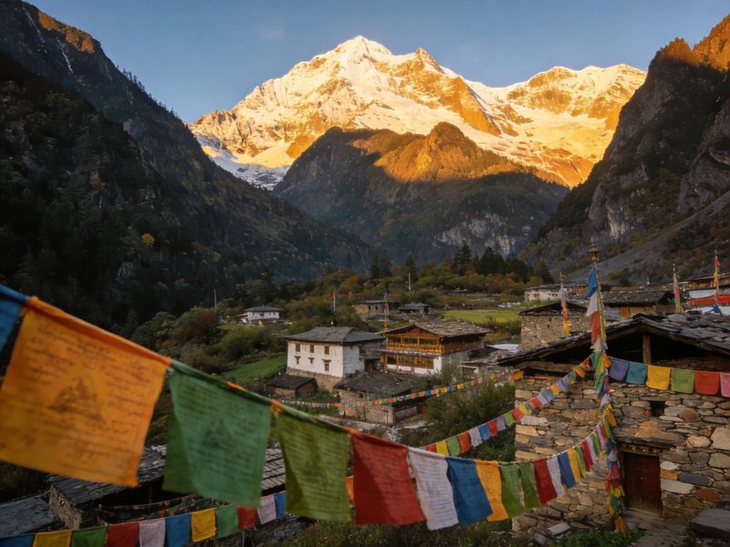
A Tibetan village accessible only by foot or on horseback, Yubeng sits in a hidden valley beneath the snow peaks of the Meili Snow Mountain range. It's been called "Shangri-La's last secret" — a place where sacred waterfalls cascade from glacial peaks, ice lakes reflect snow-capped summits, and Tibetan prayer flags flutter over ancient forests.
- Summer temp: 15-25°C
- Elevation: 3,200m (village) to 4,600m (Ice Lake)
- Duration: 4-5 days, ~55km total
- Access: Fly to Shangri-La (Diqing Airport) → bus to Xidang (西当) → hike 6 hours into Yubeng village
- Highlights: Sacred Waterfall (神瓶), Ice Lake (冰湖), Tibetan village life, Meili Snow Mountain sunrise
July is peak wildflower season — the meadows around Yubeng turn into a carpet of color, and the surrounding peaks are at their most dramatic with fresh snow contrasting against green valleys. However, some sections (particularly the Sacred Lake trail) may be long-term closed due to safety concerns — verify locally before planning your route.
See our full trail listings for more Yunnan routes, and always check current trail status before traveling to remote areas.
10. Western Sichuan Premium: Daocheng Yading & Genyen Sacred Mountain
Western Sichuan is where the Sichuan Basin gives way to the eastern edge of the Tibetan Plateau — a land of 6,000m peaks, sacred lakes, and Tibetan Buddhist culture. These are the routes that serious hikers dream about. They require more effort to reach, but the payoff is otherworldly.
Daocheng Yading (稻城亚丁): The Last Shangri-La
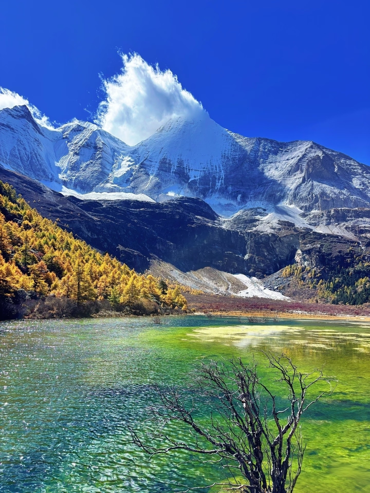
Three sacred mountains — Chenresig (5,958m), Jambeyang (6,073m), and Chanadorje (5,958m) — rise above turquoise lakes and wildflower meadows in what Joseph Rock called "the last Shangri-La." This is the landscape that inspired James Hilton's Lost Horizon.
- Summer temp: ~15°C average; 15-20°C day, 5-10°C night
- Elevation: 4,000-4,600m (Milk Lake at 4,600m, Five-Color Lake at 4,500m)
- Access: Fly Chengdu → Daocheng Yading Airport (4,411m — one of the world's highest commercial airports), or 2-day drive from Chengdu via the Southern Sichuan-Tibet Highway
- Highlights: Three sacred mountains, Milk Lake (牛妢海), Five-Color Lake (五色海), Luorong Pasture meadows
July-August is wildflower season — the meadows fill with color against the backdrop of snow peaks. But it's also rain season, with a typical pattern of "day sunny, night rain." Mornings are usually clear and spectacular; pack rain gear for afternoon showers.
Genyen Sacred Mountain (格耮神山): Sichuan's Last Wilderness
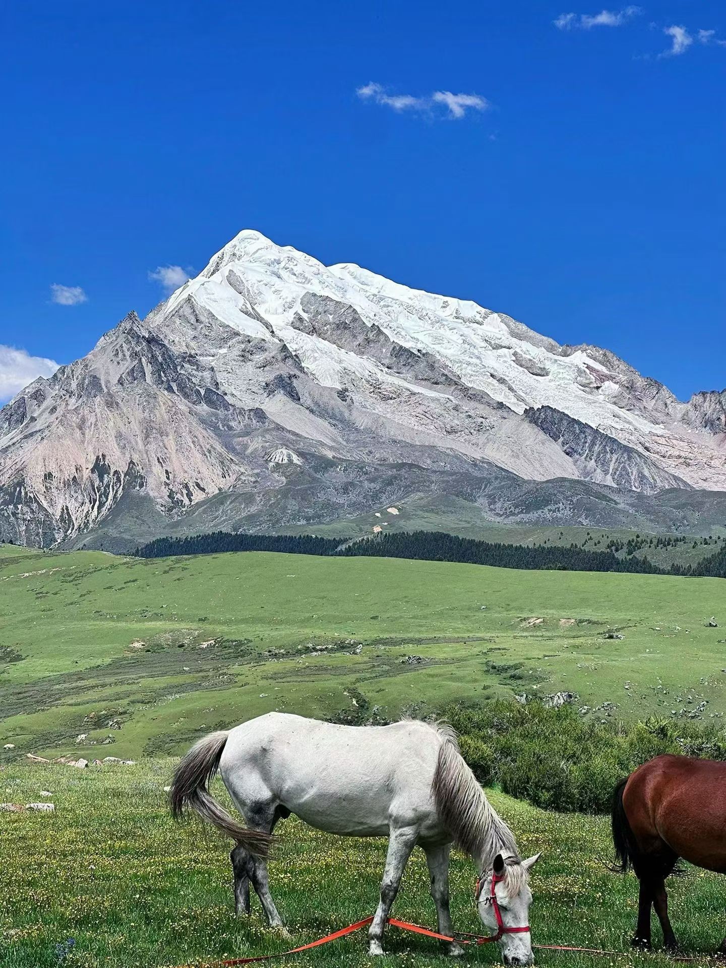
At 6,204m, Genyen is Sichuan's third-highest peak and one of the most remote trekking destinations in China. There are no towns, no phone signal, no commercial supplies along the route — just raw wilderness: snow peaks, glacial valleys, wildflower meadows, and Tibetan nomad camps. This is the "last wilderness" of the Sichuan trekking world.
- Summer temp: 10-20°C; nights can drop to 0°C
- Elevation: 4,000m+ throughout the trek
- Duration: 4-5 day trek
- Access: Drive Chengdu → Litang (理塘, "world's highest city" at 4,014m) → trailhead — 2 days total travel
- Highlights: Genyen peak views, alpine wildflower meadows (peak July), Tibetan nomadic culture, utter solitude
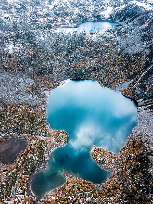
For a less extreme Western Sichuan option, Dangling's Hulu Lake offers similar scenery at lower elevations
11. Summer Hiking Safety Tips for China
China's summer mountains are beautiful but demand respect. Whether you're doing a day trip to Moganshan or a 5-day trek in Yubeng, these safety principles apply universally.
12. Quick Temperature Reference Table
Use this table to compare all 12 routes at a glance. Temperatures are July-August averages at the trail's main hiking elevation.
| City/Region | Route | Summer Temp (°C) | Elevation | Difficulty |
|---|---|---|---|---|
| Shanghai | Moganshan (苣干山) | 22-26 | 700m | Easy |
| Beijing | Donglingshan (东灵山) | 17-22 | 2,303m | Moderate |
| Guangzhou/Shenzhen | Nankunshan (南昆山) | 23-25 | 600-1,228m | Easy |
| Chengdu | Bipenggou & Siguniang (毕棚沟 & 四姑娘山) | 15-20 | 2,400-4,500m | Moderate-Hard |
| Hangzhou | Tianmushan (天目山) | 22-25 | 1,500m | Easy-Moderate |
| Xi'an | Taibaishan (太白山) | 10-18 | 3,767m | Hard |
| Xiamen | Wuyishan (武夷山) | 22-28 | 2,160m | Easy-Moderate |
| Chongqing | Jinfo Mountain (金佛山) | 16-19 | 2,238m | Moderate |
| Yunnan | Tiger Leaping Gorge (虎跳峡) | 16-23 | 2,670m | Moderate |
| Yunnan | Yubeng (雨崩) | 15-25 | 3,200-4,600m | Hard |
| W. Sichuan | Daocheng Yading (稻城亚丁) | 15-20 | 4,000-4,600m | Hard |
| W. Sichuan | Genyen (格耮神山) | 10-20 | 4,000m+ | Very Hard |
As the table shows, every route on this list stays below 28°C — most well below 25°C — while their corresponding cities bake at 33-40°C. That's the power of elevation: for every 1,000m you climb, you lose roughly 6°C. China's top tourist cities may be hot in summer, but the mountains nearby are waiting with cool air, green forests, and spectacular trails.
Need Help Planning Your Summer Hike in China?
Message us on WhatsApp for route recommendations, guide bookings, and transport arrangements. We're based in China, we know these trails firsthand, and we help foreign hikers every week.
💬 Chat with Us on WhatsApp
Last updated: August 2026. Trail conditions and weather patterns may change. Always check trail status before your trip.
More resources: All Trails · Avoid Crowds Guide · Backpacker's Guide · Trail Status
Questions? Chat with our team on WhatsApp.